Star Trek Maps · Chapter 3 · Navigation
3.3 Course Calculations
Outlines how a course is plotted once the ship's position and that of the destination are known, using the difference in coordinates to derive distance and bearing angles for the trip.
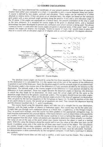
3.4 Figure 3.4 Course Plotting — three-dimensional vector diagram showing present position, destination, and the distance and bearing angles between them.
This heading introduces the sections that follow. Select a sub-section from the navigation, or view its schematics above.