Star Trek Maps · Chapter 3 · Navigation
3.2 Position Determination
Explains how a ship's position is found when the inertial reference platform is unavailable, principally by timing signals from the subspace beacon network to derive distances and resolve which quadrant and sectors the ship occupies.
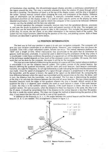
3.2 Figure 3.2 Beacon Position Location — three-dimensional coordinate diagram illustrating how beacon-to-ship distances locate a vessel within the grid.
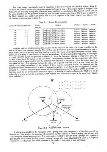
3.1 Table 3.1 Region Determination — table relating the closer quadrant boundary beacons and the north or south beacon to the resulting region and the signs of its X, Y, and Z values.
3.3 Figure 3.3 Pulsar Position Location — three-dimensional coordinate diagram showing position fixing from pulsar references.
This heading introduces the sections that follow. Select a sub-section from the navigation, or view its schematics above.